Route · 14 days · one-way
Yacht charter route · Istria, Croatia

Pomer
via 14 Days.

Two weeks from Marina Pomer: Kornati islands, Krka waterfalls, Telašćica cliffs and car-free Silba — a 14-day catamaran route through the Zadar archipelago.

Card image
The route

Day-by-day route

Click any pin on the map or any day in the Route summary below to see the daily stop, narrative, and photos.

Medulin
Day 1

Marina PomerMedulin

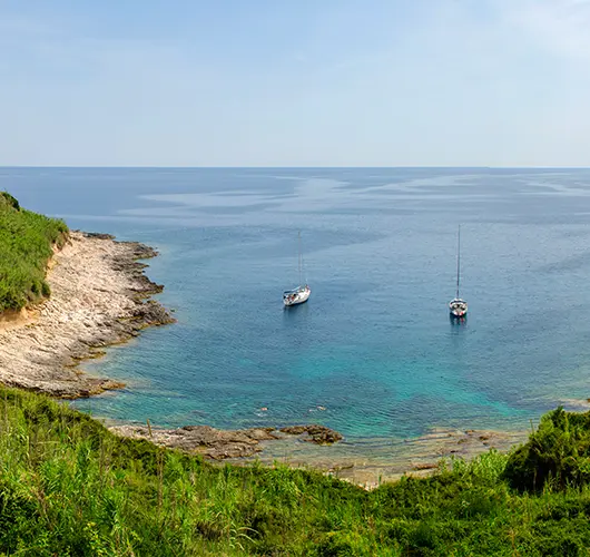
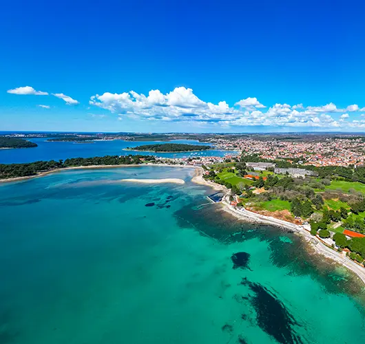
Ease into charter life with a gentle 3 NM shakedown from Marina Pomer across to Medulin's sandy lagoon. Check the rig, stow provisions, and let the crew find their sea legs before an early swim off the beaches beneath Cape Kamenjak's wild, rosemary-scented headland.

Distance

1 NM

Sailing

~0.2h at 5 kn

Route at a glance

Best season

June – mid-September (peak Jul – Aug)

Duration

14 days · Sat – Sat

Departure

Pomer

Sailing area

Istria

Route summary

Click any day to jump back to the map and see its photos, narrative, and mooring tip.

The full story

Day-by-day journey

Named anchorages, restaurants, and route notes for every leg of the week — written by sailors who've actually run this passage.

Day 1 / 14
Medulin
1
Day 1

Marina PomerMedulin

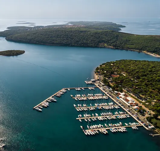
Your two weeks begin quietly, and deliberately so. After check-in and the technical briefing at Marina Pomer — a calm, well-sheltered base at the very tip of Istria — you slip the lines for a three-mile shakedown across Medulinski Bay. It is just enough water to test the sails, calibrate the instruments, and work out who on board actually likes handling the winches. Medulin's lagoon is one of the few genuinely sandy anchorages in the northern Adriatic: pale turquoise shallows, a low town waterfront, and the ridge of Cape Kamenjak closing off the horizon to the west. Drop the hook early and take the dinghy or paddleboard ashore. The town's long promenade fills with families and gelato queues on summer evenings, and konobas along the front grill fresh Adriatic fish. If energy allows, cycle or walk into the Kamenjak nature park — a bare, fragrant cape of coves and cliff-jumping ledges that you will round properly tomorrow morning.

Things to do

Swim in Medulin's shallow, sand-bottomed lagoon

Walk or cycle into the Kamenjak nature park's wild coves

Stroll Medulin's evening promenade for gelato and grilled fish

Run a full crew briefing on winches, tender and anchor gear

Mooring tip

Anchor in 3–5 m over sand in the Medulin lagoon — holding is excellent, but the bay is busy in July and August, so arrive by mid-afternoon. Alternatively keep your Marina Pomer berth for the night and make Medulin a swim stop.
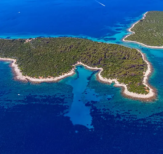
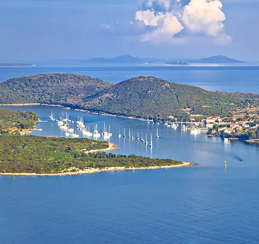
Unije
2
Day 2

MedulinUnije

Round Kamenjak early, when the morning breeze is still soft, and watch Istria's low green coast give way to open water. The 18 NM leg to Unije is the crossing where the trip properly begins: no islands to windward, a steady horizon, and — with a working northwesterly — a comfortable beam reach for a cruising catamaran. Unije rewards the passage. The westernmost island of the Lošinj archipelago has a single village of shuttered stone houses facing west into the sunset, no hotels, and a patchwork of old olive terraces and fields behind it. Pick up one of the mooring buoys in Maračol, the deep, well-protected bay on the island's eastern side, then follow the footpath over the low ridge into the village — fifteen minutes through fig trees and dry-stone walls. Dinner options are few and pleasantly simple: whatever the island's fishermen brought in that morning. Nights here are dark and silent in a way the mainland has long forgotten.

Things to do

Pick up a buoy in Maračol and snorkel the bay's clear rocky edges

Walk the ridge path from Maračol over to Unije village

Watch the sunset from the village waterfront, which faces due west

Order the day's catch at one of the village's handful of konobas

Mooring tip

Maračol has a managed mooring buoy field in 5–10 m and anchoring inside it is restricted, so plan on a buoy and arrive before late afternoon in high season. The bay is well sheltered from everything except the north.

Ilovik
3
Day 3

UnijeIlovik

Today is short by design — barely two hours underway at catamaran pace — so treat it as a swim-and-sail day. Coast down Lošinj's steep western shore, keeping an eye out for the dolphins that are regularly sighted in these waters; the Lošinj archipelago hosts a resident bottlenose population. Ilovik announces itself gently: a low, green island whose single village fills the shore of the sheltered channel between Ilovik and the islet of Sveti Petar opposite. Locals have called it the island of flowers for generations — oleander, palms and gardens crowd right down to the waterline. Moor in the channel, then wander lanes that have no cars and little hurry. For the afternoon, walk twenty minutes across the island to Paržine, a rare sandy beach facing southeast, or take the dinghy across to Sveti Petar, where the islanders' old cemetery sits among cypress trees. Evenings are what Ilovik does best: grilled fish, island wine, and the slow traffic of dinghies across the channel.

Things to do

Swim at Paržine, Ilovik's sandy southeast-facing beach

Dinghy across the channel to the cypress-shaded islet of Sveti Petar

Wander the car-free village lanes among oleander and palm gardens

Keep watch for Lošinj's resident bottlenose dolphins on the passage down

Mooring tip

Moor on one of the buoys or the small village quay in the Ilovik–Sveti Petar channel; a current runs through, so check your swing before settling. Buoys go quickly in season — be in by mid-afternoon or keep the Paržine anchorage as a fallback.

Božava
4
Day 4

IlovikBožava (Dugi Otok)

The morning's crossing is the most open water since Unije: 15 NM over the approaches to the Kvarnerić, with Dugi Otok slowly hardening on the horizon. Aim for the island's northwestern tip, where the Veli Rat lighthouse has stood since 1849 — at 42 metres the tallest on the Adriatic, its ochre tower supposedly coloured with thousands of egg yolks mixed into the mortar. If sea state allows, anchor off Sakarun on the way in: a crescent of white sand and improbable turquoise that is regularly ranked among Croatia's finest beaches. Božava itself, a few miles on, is a small, unhurried resort village with a snug harbour and a shoreline promenade winding through pines — perfect for a barefoot evening walk. The village has served sailors and swimmers since the 1920s, and it shows in the easy rhythm of the place. Provision lightly here; from tomorrow you enter the emptier, wilder half of the route.

Things to do

Anchor for lunch and a swim off Sakarun's white-sand crescent

Dinghy or walk out to the 42 m Veli Rat lighthouse, the Adriatic's tallest

Follow Božava's pine-shaded shoreline promenade at dusk

Top up water and provisions before the wilder days ahead

Mooring tip

Božava's harbour has laid moorings and shore power on the breakwater and quay, and it fills by late afternoon in summer. Sakarun is a daytime anchorage in sand at 4–8 m — lovely holding, but exposed to the northwest.

Telašćica
5
Day 5

BožavaTelašćica

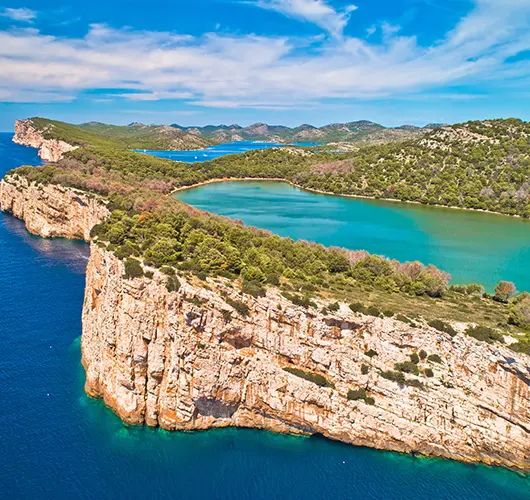
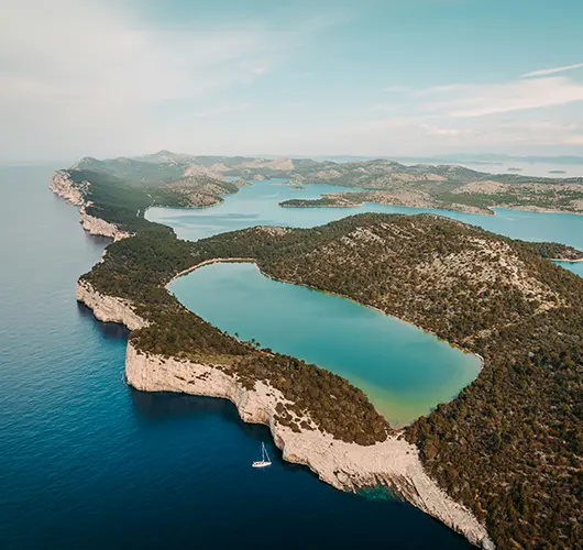
Hoist sails just outside Božava and turn southwest along Dugi Otok's seaward flank — a shore with almost no shelter and all the more spectacular for it. Toward the island's southern end the land climbs abruptly into the Grpašćak cliffs, which fall some 160 metres straight into open sea; give them respectful distance and enjoy the scale from the water. Then everything changes. Rounding into Telašćica, one of the Adriatic's largest natural harbours and a protected nature park since 1988, you find six kilometres of calm, branching bay dotted with mooring buoys. Pick one up in Mir cove and walk the marked trail to Lake Mir, a shallow saltwater lake trapped behind the ridge, noticeably warmer than the sea and slightly saltier too. The park's semi-wild donkeys usually loiter near the path, expert at charming snacks from sailors. Climb to the cliff-top viewpoint above Grpašćak for the sunset — the same wall you sailed beneath hours earlier, now glowing under your feet.

Things to do

Swim in Lake Mir, the warm saltwater lake behind the ridge

Hike up to the Grpašćak cliff viewpoint for sunset over open sea

Say hello to the park's famously food-motivated donkeys

Snorkel the rocky edges of Mir cove's clear, protected water

Mooring tip

Telašćica is a nature park: pick up one of the park buoys in Mir or the neighbouring coves and expect a ranger boat to collect the park and mooring fee. Anchoring is limited to designated zones, and the buoy fields fill early in July and August.

Kornati
6
Day 6

TelašćicaPiskera (Kornati)

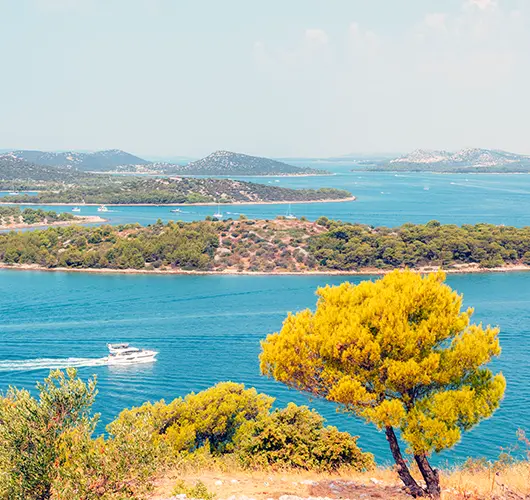
Motor gently through Mala Proversa, the narrow, shallow passage between Dugi Otok and the islet of Katina — mind the marked channel, it carries only a few metres of water — and you are in Kornati National Park. The change is immediate and slightly surreal: 89 islands, islets and reefs of pale karst, almost bare of trees, ringed with dry-stone walls built by Murter farmers over centuries. George Bernard Shaw's much-quoted line about the gods crowning their work with tears and stars was written about exactly this seascape. Sail slowly; the park rewards wandering, and today's 10 NM can happily stretch into a full day of coves. Drop anchor for lunch under the seaward cliffs — the crowns — of Klobučar or Mana if conditions allow. By afternoon, thread your way into ACI Marina Piskera, built on the islet of Panitula Vela and one of the most atmospheric berths in the Adriatic: a pontoon village in a stone desert, with sunsets that silence the whole marina.

Things to do

Thread the shallow Mala Proversa channel into the national park

Anchor for lunch beneath the 'crowns' — the seaward cliffs of Mana or Klobučar

Hike a dry-stone-walled ridge above Piskera for the archipelago panorama

Watch the sun set over the outer Kornati from the marina pontoon

Mooring tip

ACI Piskera is open roughly April–October; berths have lazy lines, but water and power are rationed, so arrive with tanks topped up. Your Kornati park ticket is mandatory — buying it online in advance is cheaper than from the ranger boat.

Zlarin
7
Day 7

PiskeraZlarin

Make an early start — today you sail the full length of the lower Kornati before open water to the Šibenik islands. Leaving Piskera, pick your channel south past Lavsa and Ravni Žakan, then let the autopilot rest while everyone takes a turn on the helm; with the afternoon maestral filling in from the northwest, the last stretch is often the best sailing of the fortnight. Zlarin greets you with pines instead of karst. The island has banned cars entirely, and its broad riva — lined with stone houses and mulberry trees — belongs to walkers, cats and moored yachts. For five centuries Zlarin's divers and boats harvested red coral, and the story is beautifully told in the Coral House interpretation centre just off the harbour. Swim off the pine-backed coves east of the village, then take the evening slowly: this is an island of a few hundred winter residents that knows a thing or two about not hurrying.

Things to do

Visit the Coral House to see Zlarin's 500-year red-coral story

Walk the car-free riva under its mulberry trees at dusk

Swim in the pine-fringed coves east of the harbour

Sail the channel past Lavsa and Ravni Žakan on the way out of the park

Mooring tip

Zlarin offers mooring buoys in the bay and a village quay with laid lines; depths at the quay run about 2.5–4 m. It is popular with Šibenik weekenders, so call ahead or arrive early on Fridays and Saturdays.

Skradin
8
Day 8

ZlarinSkradin

Today the sea narrows into a river. From Zlarin it is a couple of miles to the entrance of the St. Anthony channel, the slender natural cut guarding Šibenik — watch for the 16th-century St. Nicholas fortress, UNESCO-listed, crouched on its islet at the mouth. The channel opens into Šibenik's bay beneath the cathedral of St. James, then the route bends north into the Krka canyon: steep, green, and utterly unlike the open Adriatic you have sailed all week. Reeds replace rocks, herons replace gulls, and the water under your hulls turns gradually brackish, then fresh — a free rinse for the boat after a week of salt. Skradin appears at the head of navigation, a small stone town the Romans knew as Scardona, its riva stacked with yachts staging for the national park. Berth at ACI Marina Skradin and give the evening to the town: bell tower, narrow lanes, and konobas known for peka dishes and Skradin's famously slow-cooked risotto.

Things to do

Photograph the UNESCO-listed St. Nicholas fortress at the channel mouth

Spot herons in the reed beds of the Krka canyon on the way up

Climb to the Turina fortress ruin for a view over Skradin's riva

Order skradinski rižot, the town's famous hours-long risotto

Mooring tip

ACI Marina Skradin sits in fresh, current-free water right below the town; book a berth ahead in summer, as it is the natural base for NP Krka. Alternatively anchor just downstream of the town, keeping well clear of the fairway.

NP Krka
9
Day 9

SkradinNP Krka

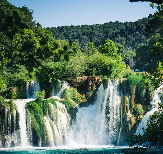
Leave the fenders where they are — today is for waterfalls. National park boats run from Skradin's riva up the final unnavigable stretch of the Krka to Skradinski Buk, the park's showpiece: seventeen travertine steps stacked over 45 metres, thundering brightest in early summer. A circular boardwalk trail — allow ninety unhurried minutes — loops over rapids and glassy pools, past restored watermills where wool was once fulled and grain ground by the falls themselves. Swimming beneath the cascade has been prohibited since 2021, protecting the fragile travertine, but the spectacle more than compensates. With an afternoon in hand, take the optional park boat further upstream to Visovac, the tiny island monastery the Franciscans have kept since the 15th century, floating improbably in its lake. Back in Skradin, join the evening ritual: the whole town, sailors included, walking the riva as the swifts come out. It is exactly the mid-cruise pause a two-week itinerary is designed around.

Things to do

Walk the boardwalks under Skradinski Buk's seventeen travertine steps

Explore the restored watermills of the falls-side ethno village

Take the park boat upstream to the Visovac island monastery

Join Skradin's riva passeggiata before dinner

Mooring tip

No mooring decisions today — keep your ACI Skradin berth for a second night. Buy NP Krka tickets online the evening before to skip the morning queue; the park boat from Skradin's riva is included in the ticket.

Murter
10
Day 10

SkradinMurter

Slip out of Skradin early enough to have the canyon to yourself — the morning light on the reed beds is worth the alarm — then run back through Šibenik's channel and out to sea. The 30 NM to Murter can be sailed inside the islands past Vodice and Tribunj or outside via Zlarin and Prvić; with a fresh maestral, the outer route gives a cracking reach. Murter is the island that owns the Kornati — literally: most of the national park's land belongs to families here, who for generations sailed out to tend sheep, olives and vines. Their working boats, the gajeta, are still built and restored in Betina, whose Museum of Wooden Shipbuilding is small, passionate and genuinely moving. Berth at Marina Hramina or Betina, swim at sandy Slanica as the crowds thin, and end the day at a konoba above the town with the whole Kornati archipelago laid out to the southwest, exactly where you sailed three days ago.

Things to do

Visit Betina's Museum of Wooden Shipbuilding, home of the gajeta

Swim off sandy Slanica beach in the late-afternoon lull

Dine at a hillside konoba with the Kornati spread out below

Wander Murter town's old quarter and its boatyards at golden hour

Mooring tip

Marina Hramina in Murter town and Betina Marina both take catamarans with full services; Hramina is handier for restaurants, Betina quieter. In peak season reserve by phone the day before — Murter is the main Kornati staging port.

Sutomišćica, Ugljan
11
Day 11

MurterSutomišćica (Ugljan)

The Pašman channel is the Adriatic in miniature: a long, protected lane of green water between the islands and the mainland, busy with local ferries, fish farms and more islets than you will bother counting. The tide runs through here more strongly than almost anywhere on this coast, so time your passage with the current if you can and enjoy the extra knot. Abeam of Turanj, detour for the obligatory slow circle of Galešnjak, the uncannily heart-shaped islet that made world news when Google Earth found it. Sutomišćica, tucked into Ugljan's channel shore, is a proper hideaway: a deep, all-but-landlocked bay ringed by the olive groves that give the island — and the bay's Olive Island Marina — their name. Ugljan's oil has been pressed since Roman times, and the marina's shop and village konobas pour it generously. After dinner, walk out to the headland: across the channel, Zadar's waterfront lights up, close enough to touch and blissfully far away.

Things to do

Circle Galešnjak, the heart-shaped islet of the Pašman channel

Taste Ugljan olive oil, pressed on the island since Roman times

Swim in the calm, green water of Sutomišćica's inner bay

Watch Zadar's skyline light up across the channel after dinner

Mooring tip

Olive Island Marina in Sutomišćica has lazy-line berths with full services and easily takes wide beams; the bay itself also allows anchoring in 4–8 m over good mud. Currents in the Pašman channel can exceed two knots — factor them into your ETA.

Silba
12
Day 12

SutomišćicaSilba

Two very different harbours share today. First, an hour's hop across the channel to Zadar: tie up on the city quay long enough to walk the marble streets of the peninsula, stand on the steps of the Sea Organ — an artwork that turns swell into eerie, endless chords — and see the Greeting to the Sun beside it, the Roman forum and the ninth-century rotunda of St. Donatus behind. Alfred Hitchcock famously declared Zadar's sunset the world's finest, but you will be watching tonight's from somewhere quieter. The afternoon leg runs 20-odd miles northwest past Molat and Olib to Silba, once a shipowners' island rich on sail freight, now a summer haven that bans cars year-round and even bicycles in high summer. Climb the Toreta, the hexagonal tower with an external spiral stair built, the story goes, by a lovelorn sea captain, for a 360-degree view over the whole northern archipelago — including tomorrow's route to Susak.

Things to do

Listen to Zadar's Sea Organ play the midday swell

Walk the Roman forum and circle St. Donatus' ninth-century rotunda

Climb Silba's Toreta tower for a 360-degree archipelago view

Stroll the car-free lanes between Silba's two harbours at dusk

Mooring tip

Off Silba village, pick up a buoy or anchor off Žalić in 4–8 m of sand — decent holding but open to the southeast; in a scirocco shift to the island's western side. Zadar's city quay works for a lunch stop, but keep someone aboard for ferry wash.

Susak
13
Day 13

SilbaSusak

Geologically, Susak should not exist: a cap of fine yellow loess, tens of metres deep, laid by ice-age winds on a limestone shelf far out in the Kvarner. The result is an island of soft contours and sandy shallows in a sea of grey karst. Sail the 15 NM from Silba across open water — this is an exposed leg, so check the forecast — and anchor off Spiaza, the broad, thigh-deep bay below the village, where the water warms like nowhere else on this route. Ashore, the village climbs in two tiers, Donje and Gornje selo, linked by sandy sunken lanes between vineyard terraces shored up with planted reeds — a farming system found nowhere else on the coast. Susak's families have made wine this way for centuries and many still sell it at the cellar door; ask politely and taste. Half the island's population emigrated to New Jersey in the 1950s, and the returning generations give the place its bilingual, faintly time-capsule charm.

Things to do

Wade out across Spiaza's warm, waist-deep sand shallows

Climb the sunken sandy lanes to Gornje selo, the upper village

Taste homemade wine straight from a family cellar

Walk the reed-braided vineyard terraces above the bay

Mooring tip

Susak's small harbour mole is tight and mostly taken by locals and the ferry, so most yachts anchor off Spiaza in 3–6 m of superb sand holding. The bay is open to the north and east — treat Susak as a settled-weather stop with Unije or Lošinj as plan B.

Marina Pomer
14
Day 14

SusakMarina Pomer

Save some appetite for the last day — it is a proper passage, not a delivery trip. From Susak the course lies northwest across 27 NM of open water, retracing in reverse the crossing you made a fortnight ago, and there is quiet satisfaction in how much better the crew reads the sea now. Four to five hours at catamaran pace means an early start buys you the whole afternoon. If the morning is settled, close the Istrian shore at Cape Kamenjak and anchor in one of the south-facing coves near the cape's tip for a long brunch swim — the water off this wild, protected headland is some of the clearest of the entire route. The final three miles around into Medulinski Bay replay day one in miniature, this time with practiced hands on the lines. Refuel, berth at Marina Pomer by early evening as check-out requires, and toast the log over a last Istrian dinner: fourteen days, a dozen islands, two national parks, one thoroughly salted crew.

Things to do

Anchor for a brunch swim in a south-facing Kamenjak cove

Log a final open-water watch on the 27 NM crossing home

Refuel and tidy the boat before evening check-in at Pomer

Celebrate the fortnight with a farewell Istrian seafood dinner

Mooring tip

Kamenjak's coves are settled-weather lunch stops only — anchor in 3–6 m over sand and rock, and don't linger if a southerly builds. Be alongside in Marina Pomer with fuel topped up by early evening, as charter check-out requires.

— Plan your week

Sail this route — we'll match a yacht to it.

Send dates, group size and preferred vessel style. A broker replies with a tailored quote within hours.