— Route · 14 days · round-trip
Yacht charter route · Split, Croatia

Split
via Dubrovnik (14 Days).

A fortnight from Split down the outer islands to Dubrovnik, out by Hvar, Vis, Lastovo and Mljet, home by Korčula, Jelsa, Brač and Šolta, with wind notes.

Split – Dubrovnik (14 Days)
Map and stops

Where each day goes

Tap a pin on the map, or a day in the leg-by-leg list further down, to open that stop with its notes and photos.

Milna
Day 1

Split → Milna (Brač)

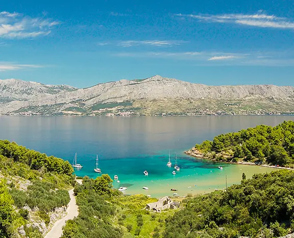
A gentle first afternoon: eleven miles from Split to the long harbour of Milna on the west side of Brač. Time enough to learn the boat on the way, swim at anchor, and still sit down to a slow-cooked peka in the village.

Distance

11 NM

Sailing

~2.2h at 5 kn

This week in brief

When to sail

May to early October, busiest June to September

Duration

14 days · Sat – Sat

Departure

Split

Sailing area

Split

Leg by leg

Pick a day to go back to the map with that day's photos, notes and berthing advice.

In detail

The week, day by day

Each leg written out: where the day takes you, where to swim and eat, and where to tie up for the night.

Day 1 / 14
Milna
1
Day 1

Split → Milna (Brač)

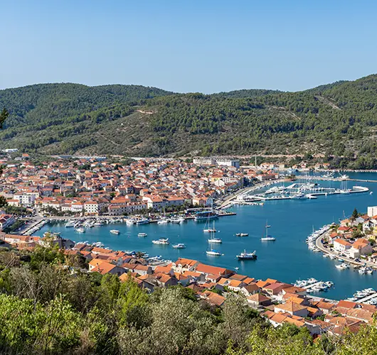
Treat the first crossing as a shakedown. The Brački Kanal is open water but the run to Milna is only 11 nautical miles southwest, so there is room to sort lines, hoist and reef the headsail once or twice, and find out how the boat behaves before any leg that matters. Milna opens up at the end of a long inlet on the western coast of Brač, and the 17th-century parish church on the inner quay gives you the line in. Stone houses climb back from the water. The harbour has worked since Venetian times and today fishing boats share it with charter yachts. Rather than heading straight for the quay, stop in the outer anchorage first and swim. Then go in and, before anything else, order the lamb under the peka: it needs three hours under the embers, and the evening is built around that wait.

Things to do

Put in the peka order as soon as the lines are fast

Swim at anchor in the outer bay first

Look into the parish church by the inner quay

Buy Brač olive oil from a village shop

Run the dinghy over to Osibova Bay at sunset

Mooring tip

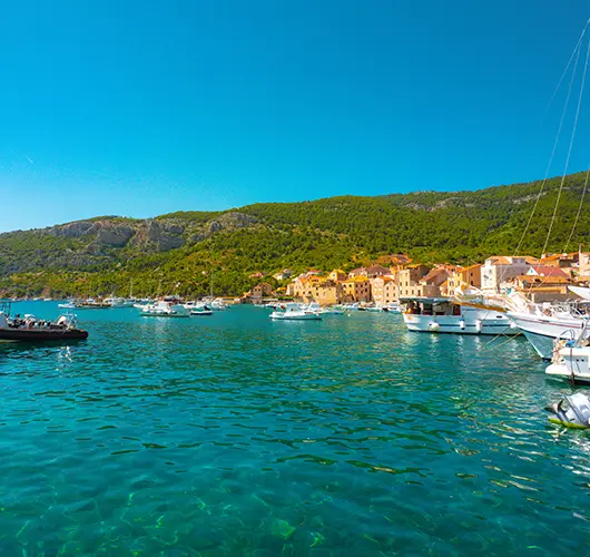
Lie stern-to on your own anchor at the town quay; there is a modest fee, with water and power along the inner part. The bay opens to the southwest and west, so an afternoon Maestral can send swell in; if it is forecast or the quay is full, Bobovišća 3 NM north stays calm in westerlies.
Palmižana
2
Day 2

Milna → Palmižana (Hvar)

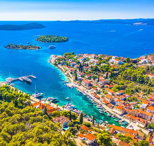
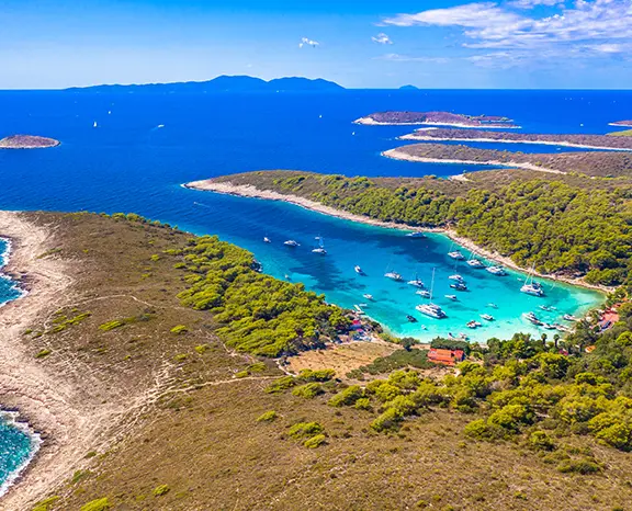
Leave Milna after breakfast and steer southeast for 15 miles over the Hvar Channel. The Pakleni Islands lie ahead as a low line of pine-covered islets screening the southern approach to Hvar Town. Palmižana, a bay on the biggest island of the cluster, is the one with a small marina. Plan your berth around the afternoon wind. The main bay gives decent holding in 5 to 10 metres of sand and weed, but once the Maestral fills in the gap between St. Klement and Hvar funnels it and the anchorage starts to roll. Most crews either book a stern-to berth on the ACI pontoon or tuck into a south-side cove such as Vinogradišće or Tarsce, which hold better in a westerly. With the boat settled, walk the Meneghello botanical garden, the 1906 estate that first drew visitors here, and take lunch at one of the four restaurants around the bay. Late in the day, snorkel off the western shore over the sunken Roman amphorae.

Things to do

Snorkel the sunken amphorae off the western shore

Wander the Meneghello botanical garden

Take the dinghy to Marinkovac's quieter beach

Order a cold Plavac Mali by the quay

Ride the water taxi to Hvar Town after dark

Mooring tip

ACI Marina Palmižana has lazy lines but must be booked online for July and August. If it is full, Vinogradišće on the south side (sand and weed, line ashore as usual) is better in an afternoon westerly; do not stay overnight in the main bay when a southwesterly is building.

Hvar
3
Day 3

Palmižana → Hvar Town

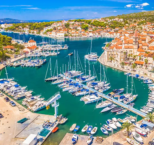
Today's hop is the shortest of the first week, two nautical miles back over the channel, so you can leave late and still arrive early. From the water Hvar Town is easy to read: the Fortica fortress above the roofs, the stone arches of the Arsenal along the front and St. Stephen's Cathedral at the main square. The berthing decision is the important one. The town quay will take you for a fee, but by midday it is packed with tour boats, taxis and tenders from big yachts, and it has no cover from the Maestral that funnels in during the afternoon. A reserved berth in Hvar Town harbour is the sensible overnight for a 12-metre yacht in anything but a flat calm. Berth there and walk into town. Go up to the Fortica early, before the heat and the crowds; on a clear day the view over the Pakleni reaches Vis. In the evening, eat in a konoba off the square and finish on the harbour wall.

Things to do

Reach the Fortica early for the Pakleni view

See the Arsenal arches and St. Stephen's Cathedral

Eat at a konoba in the lanes behind the square

Browse the lavender shops off Trg Sv. Stjepana

Watch boats come and go from the seawall

Mooring tip

Book a berth in Hvar Town harbour ahead and treat it as the only overnight in any wind; it has lazy lines, water and power. The town quay charges a high fee by the hour, is crowded with tenders and open to westerly gusts, so use it for a daytime visit only in season.

Komiža
4
Day 4

Hvar → Komiža (Vis)

Plan this one with care: it is 25 miles west from Hvar, out past the Pakleni and over open water to Vis, the most westerly inhabited island in Croatia and a closed military zone until 1989. Leave mid-morning and aim at the south coast, which is cut into a string of coves. The one to stop for is Stiniva, an almost round bay inside cliffs about a hundred metres high, with a mouth so narrow it barely shows from outside. Anchor on sand in 8 to 10 metres, keeping clear of seagrass, and swim. Day-trip RIBs pour in from late morning, so arrive before them or wait until they leave. From Stiniva it is four miles west to Komiža, the old fishing port. Head for the inner basin, where you lie stern-to on your own anchor; the outer wall takes southwest swell. Ashore the fishing fleet still works, konobas grill bogueroni with the island's Vugava white, and the sun goes down straight into the open Adriatic.

Things to do

Swim in Stiniva ahead of the RIB crowd

Stroll the fishing harbour in late light

Pair grilled bogueroni with a glass of Vugava

Climb Mount Hum for the island panorama

Explore Tito's Cave and its wartime tunnels

Mooring tip

Use the inner basin of the town quay, stern-to on your own anchor in sand and weed with mostly good holding; a harbour fee applies. The outer wall is exposed to southwest swell. If more than 15 kn from the southwest or west is forecast, go 6 NM north to Vis Town in St. George Bay, which is well sheltered.

Vela Luka
5
Day 5

Komiža → Blue Cave (Biševo) → Green Cave (Ravnik) → Vela Luka (Korčula)

Set the alarm. The Blue Cave on Biševo shows its colour only from about 09:00 until noon, while the sun shines through the opening under the water and fills the cave with deep blue. Private dinghies are not allowed inside, so tie up at the small concession quay by the entrance, where a lunchtime fee applies and overnight stays are not permitted, and wait for one of the official boats. About forty minutes later you are back aboard and heading a short way east to Ravnik. Its Green Cave (Zelena špilja) is lit from a hole in the roof that turns the floor emerald, and here you can take your own dinghy in, with far fewer people around. The longer passage comes after lunch: 18 miles southeast to Vela Luka, the deep, west-facing harbour at the far end of Korčula. It is well protected from north through east and has a full set of town services. In the evening, find a konoba on the quay for žrnovski makaruni, the island's hand-rolled pasta.

Things to do

Be at the Blue Cave tenders before mid-morning

Paddle the dinghy into Ravnik's Green Cave

Keep the south cliffs of Vis close on passage

Try žrnovski makaruni at a Vela Luka konoba

Walk the Vela Luka seafront at dusk

Mooring tip

Lie stern-to on your own anchor along the long town quay for a modest fee, with water, power and a fuel pump at the western end. Mud and sand give excellent holding. North to east are covered; only a southerly above 18 kn sends swell into the inner harbour, and the inner pontoon stays comfortable even then.

Zaklopatica
6
Day 6

Vela Luka → Lastovo (Zaklopatica)

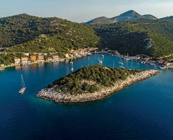
Point the bow south out of Vela Luka. Nineteen miles of open water separate Korčula from Lastovo, a Nature Park with the lowest light pollution in Croatia and as much quiet as the Adriatic offers in summer. The natural overnight is Zaklopatica on the north coast, a U-shaped bay with a low islet across its mouth that stops the swell. Five family konobas each keep a line of free mooring buoys for crews who come ashore to eat. Take a buoy, row in, walk round the bay and pick your table. The island lives on lobster (jastog) and šporki makaruli, a rich beef and pasta dish whose name means dirty macaroni. There is not much else to fill the hours beyond snorkelling and reading, and nothing more is needed. After dark the sky takes over; on a clear August night the Milky Way is overhead before the last plates are cleared. Keep an eye on the forecast. If a southeasterly is coming or the buoys are taken, Skrivena Luka on the south coast is the shelter.

Things to do

Take a free buoy and book dinner with it

Order lobster or a plate of šporki makaruli

Row over to the islet guarding the entrance

Hike to the fumari chimneys of Lastovo Town

Lie out on deck for the Milky Way

Mooring tip

Agree a buoy with the konoba when you arrive; your dinner booking secures it, and anchoring is discouraged because of the seagrass. The bay is sheltered from north to west. With more than 15 kn from the southeast forecast, go 4 NM south through the channel to Skrivena Luka (Portorus).

Mljet
7
Day 7

Lastovo → Mljet (Polače)

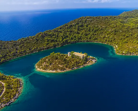
Expect a long, steady leg: 22 nautical miles northeast to Mljet. The best part comes at the end, when the narrow entrance to Polače on the north coast opens into a deep inlet between pine-covered hills. You hardly see the gap until you are through it. Polače is where the western side of Mljet National Park begins, and the National Park also manages the bay. Either take a green Park buoy, paying at the ranger kiosk on the front (the fee includes Park entry for the crew), or find a stern-to place at the small village pontoon. Right on the waterfront stand the remains of a Roman complex from the 4th century; you can walk in among the basilica walls and the corner tower without paying. Then take the path, about thirty minutes, to Veliko Jezero, the larger of the two saltwater lakes. A small Park boat crosses to St. Mary's islet and its 12th-century Benedictine monastery. Give the lakes the whole afternoon: the trail circles both, you may swim in them, and the cicadas are loud.

Things to do

Settle the Park buoy fee at the kiosk

Explore the Roman basilica walls by the water

Cross by Park boat to St. Mary's islet

Swim in the cool water of the lakes

Walk the long trail around both lakes

Mooring tip

The Park lays paid buoys here; pay the ranger on arrival, and the fee covers Park entry for the crew. It is one of the best-protected bays on the southern coast, closed to north, northeast, east and southeast, and the village pontoon also takes a few boats stern-to on their own anchor.

Dubrovnik
8
Day 8

Mljet → Dubrovnik

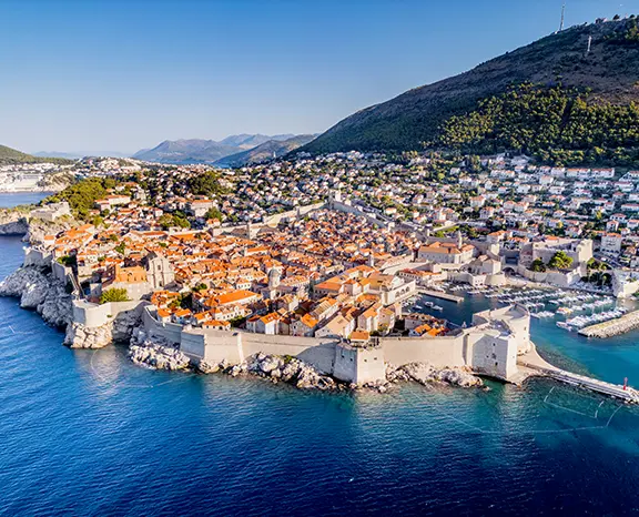
The Maestral is your friend today. From Polače, Dubrovnik is 34 miles southeast, and in settled summer weather the westerly usually builds by mid-morning and carries you down the coast. Do not plan on the Old Port itself. It is a protected UNESCO setting and lovely to look at, but it takes daytime visitors only, is open to a southerly and is busy with tenders all season. Charter yachts spend the night at ACI Marina Dubrovnik in Komolac, eight kilometres inland at the head of the Rijeka Dubrovačka, a long estuary that feels like a fjord. Every berth has lazy lines, water and power, and there is a fuel pontoon. From the pontoon, Bus 1A or a taxi gets you to Pile Gate and the top of the Stradun in about fifteen minutes. Walk the city walls, starting from Pile before sunset; the loop takes about an hour and a half and the views over the roofs are the classic ones. Afterwards, find dinner in a side street off Prijeko, away from the main flow.

Things to do

Do the full walls loop before the sun sets

Find a table in a lane off Prijeko

Ride the cable car up Mt. Srđ

Tour the Rector's Palace and Franciscan cloister

Have a drink at Buža below the south wall

Mooring tip

Book ACI Marina Dubrovnik in Komolac ahead in season; it is the only real overnight, with lazy lines and full services. The Old Port is for tenders by day only. Allow half an hour door to door from the pontoon to Pile Gate by Bus 1A or taxi.

Okuklje
9
Day 9

Dubrovnik → Okuklje (Mljet)

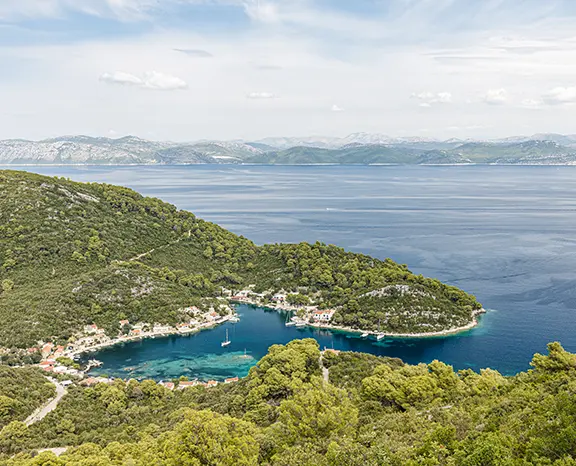
The homeward half starts with 20 miles northwest. Okuklje, on Mljet, is the exact opposite of the city you have just left. There is no town and no day-tripper traffic, just three family konobas round a tight U-shaped bay with space for perhaps twenty boats. The bay lies outside the National Park, so there are no Park fees, and the konobas put out their own free buoys for diners. What makes it a good night's stop is the shape: a long crescent with hills around a hundred metres high on three sides, so the wind dies at sunset whatever the gradient is doing outside. Swim from the boat in the afternoon, then walk the path round the headland for the view towards Korčula. At dinner, black risotto (crni rižot) coloured with cuttlefish ink and the catch of the day are the usual choices. There is no nightlife at all, which is why you came.

Things to do

Moor on a konoba buoy and reserve a table

Choose black risotto or the catch of the day

Follow the headland path for the Korčula view

Swim off the stern in still water

Enjoy a silent night far from town

Mooring tip

The konobas' buoys are free and a dinner booking holds yours; confirm when you arrive. Anchoring is possible but holding in the seagrass is patchy. The bay is sheltered north, east and south; only a northwesterly above 18 kn brings swell into the entrance, and the inner bay stays comfortable.

Korčula
10
Day 10

Okuklje → Korčula Town

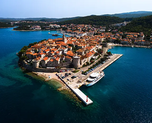
Twenty-nine miles northwest up the Pelješac Channel ends at Korčula Town, a walled medieval port at the island's eastern end. You recognise it from far off: a peninsula of red roofs under one bell tower, with the limestone walls running down to the sea on three sides. There are two places to berth, and the wind decides between them. ACI Marina Korčula, on the eastern side of the peninsula, has lazy lines and full services. The town quay on the western side takes a few boats stern-to on their own anchor for a harbour fee; it is nearer the gates, but it is open to the west and turns rolly when the Maestral comes through the channel. The Old Town is tiny, ten minutes from one end to the other, and its side streets leave the main street in a fishbone pattern. The Cathedral of St. Mark and the 14th-century Marco Polo House are the main sights, though the house's link to the explorer is disputed. Walk the streets at dusk, after the day ferries have gone back to Split.

Things to do

Stroll the walled streets as evening falls

Climb St. Mark's bell tower

Look in at the disputed Marco Polo House

Eat fish brodet in a back-lane courtyard

Catch a Moreška sword dance in season

Mooring tip

ACI Marina Korčula on the east side is the all-weather choice, with lazy lines, water and power. The town quay on the west side takes stern-to boats on their own anchor, but it is open to the Maestral and rolly in summer afternoons. If the channel gets rough, Lumbarda Bay 3 NM southeast is the sheltered alternative.

Jelsa
11
Day 11

Korčula → Jelsa (Hvar)

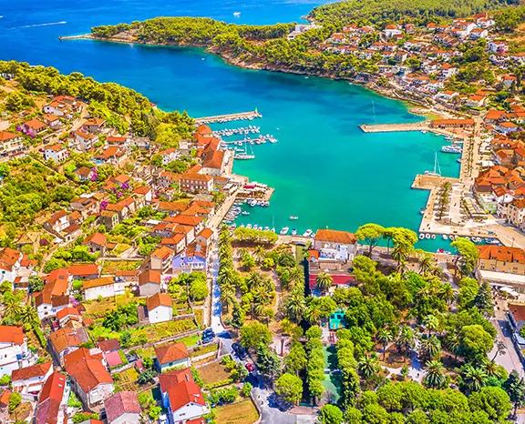
Today is a solid forty-two miles or so from Korčula, round the eastern tip of Hvar and along the Hvar Channel, ending in Jelsa in the middle of Hvar's north coast. Jelsa is the island's third town, about half the size of Hvar Town and far quieter. The bay is wide, with good holding in mud and sand along the town quay, where you lie stern-to on your own anchor for a harbour fee. A small marina on the eastern side offers lazy lines and shore power. Its weak side is the north, which matters little in summer, apart from the occasional late-season Bora. Jelsa is also where Hvar's farming country begins. Lavender fields line the road inland to Vrboska and Stari Grad and are still harvested commercially every July, and the konobas in the back streets pour the local Bogdanjuša white with Faros cheese. For the afternoon, walk or hire a bike for the three miles of coast road to Vrboska, called the little Venice of Hvar for its canal and bridges, and come back to Jelsa for dinner.

Things to do

Cycle the coast road to Vrboska and back

Taste Bogdanjuša white in a back street

Hike up to the Tor watchtower

Buy lavender oil from a producer in season

Walk out across the Stari Grad Plain

Mooring tip

Lie stern-to on your own anchor at the town quay for a modest fee, with water and power on the central section. The bay is sheltered from the south, southeast and southwest but open to the north, which in summer usually means only a late-season Bora; the small eastern marina with lazy lines is the fallback.

Lučice
12
Day 12

Jelsa → Lučice Bay (Brač)

Only a short passage today, north-west to Brač, so it is done by late morning. Lučice is a set of small bays joined side by side on the south-west coast, near Milna. The headland is empty of houses, with white limestone cliffs and pine trees, and the only buildings are two summer beach restaurants that lay free buoys for their dinner guests. Take a buoy in the deepest of the three coves and go swimming; there is very little else on the schedule. The water is the reason to come. Brač's white stone, the same stone used for Diocletian's Palace and, it is said, for parts of the White House in Washington, makes the seabed pale, and on a calm summer day you can see about 20 metres. Ashore the two restaurants keep it simple with grilled fish and the local Plavac Mali. No nightlife and no shops: a deliberately easy day before the final legs home.

Things to do

Moor on a restaurant buoy in the middle cove

Snorkel over the pale limestone bottom

Eat grilled fish with a glass of Plavac Mali

Dinghy across to the neighbouring inlets

Paddle a SUP along the headland at sunrise

Mooring tip

The restaurants' buoys are free if you dine ashore; check with them when you arrive. If they are all taken, anchor in 8 to 12 metres on sand and weed. If strong wind is forecast, shift to the sheltered harbour at Milna nearby.

maslinica
13
Day 13

Lučice → Maslinica (Šolta)

Pick your moment for the last full passage: fifteen miles northwest to Maslinica at the western tip of Šolta. The harbour is deep and winds in an S-shape. The village sits round its inner half, while seven small islets lie across the outer half, the largest of them, Stipanska, blocking the swell from the open sea. You have two choices of berth. On the south side, Martinis Marchi marina has lazy lines, water, power and full services, attached to an 18th-century baroque castle that is now a hotel and restaurant. Opposite, the village quay takes boats stern-to on their own anchor. The marina is the more comfortable choice, the quay the cheaper and more characterful one. Šolta is the nearest of the central Dalmatian islands to Split and the quietest, with almost no charter traffic outside Maslinica. Konobas on the square cook with Šolta olive oil and pour the island's Dobričić red. The return to base is twelve miles east, so the morning will not be rushed.

Things to do

Wander into the Martinis Marchi castle courtyard

Row to Stipanska and swim off the islet

Taste Šoltansko olive oil in a konoba

Try a glass of local Dobričić red

Watch sunset from Polebrnjak islet

Mooring tip

Martinis Marchi Marina on the south side has lazy lines and full services and is the all-weather option; book ahead in July and August. The village quay on the north side takes stern-to boats on their own anchor for a modest fee. The islets at the entrance shelter the bay from south through northwest; only northerlies, rare in summer, get in.

Split
14
Day 14

Maslinica → Split

Make the final leg an early one. It is twelve miles east from Maslinica back to base, and at first light the Maestral has not yet started, so you cross on flat water. The handover routine is the same on every Saturday charter: the boat must be at base with the fuel topped up, holding tanks emptied, decks rinsed and inventory checked, and the skipper should be on hand for the inspection in the morning window. Boats on this route are usually based at ACI Marina Split, Marina Kaštela or ACI Trogir, and all three are easy to enter in any visibility; your contract shows which is yours. Arriving early also leaves time for one last walk through Diocletian's Palace. Then it is lunch on the Riva and the transfer to the airport.

Things to do

Refuel and pump out ahead of the check

Take a last walk through Diocletian's Palace

Swim at Bačvice Beach east of the centre

Buy Šoltansko olive oil at the Pazar market

Linger over lunch on the Riva

Mooring tip

Return to the base named in your contract, whether ACI Marina Split, Marina Kaštela or ACI Trogir, and berth stern-to or alongside as the base manager directs. Handover runs on Saturday morning; if your contract asks for night-before return, be in on Friday afternoon.

— Plan your week

Book this week and we'll find the boat for it.

Tell us your dates, how many of you are sailing and the kind of boat you like. A charter agent sends a quote for this route within hours.